MAPS
Copper Harbor Map
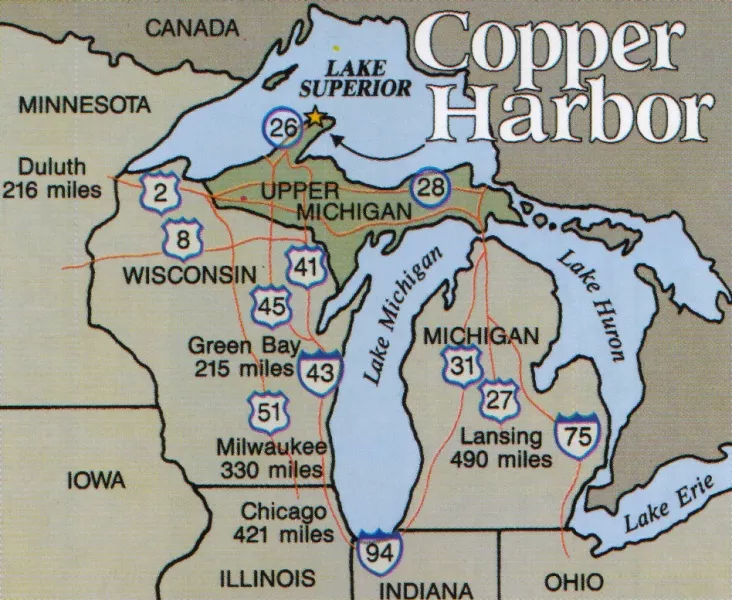 Michigan’s northern-most community, located at the tip of the Keweenaw Peninsula. Copper Harbor is home to about 80 year round residents and has a population of around 300 people in the summer months. Our “home base” hosts a number resorts, motels, restaurants, shops, a brew pub and Fort Wilkins State Park and is your gateway to adventure! Click the map for a larger view!
Keweenaw Peninsula Map
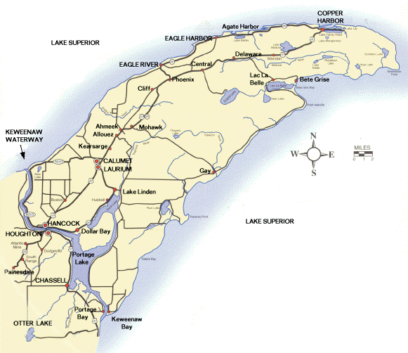 The “copper island” is the Upper Peninsula’s northern-most peninsula. The Keweenaw Peninsula ultimately extends for nearly 70 miles north and east into the center of Lake Superior. Michigan’s state motto reads “If you seek a pleasant peninsula, look about you”…nowhere else in the state is this more evident! Click the map for a larger view!
Lake Superior Map
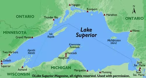 The world’s largest fresh-water lake, by surface area. Lake Superior has more volume of water than the other four Great Lakes combined, along with two additional Lake Erie’s. Click the map for a larger view!
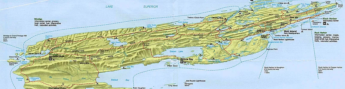
Isle Royale Map
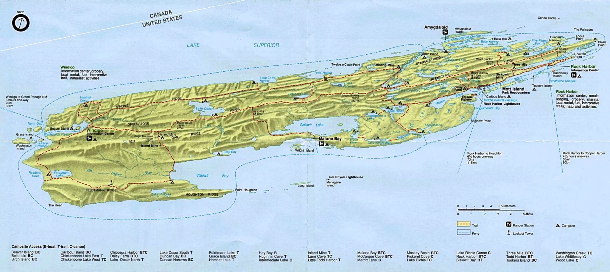 Isle Royale National Park is the largest island within the world’s largest fresh-water lake (Lake Superior). Regularly scheduled passenger ferry service is available between Copper Harbor and Rock Harbor, Isle Royale on board the Isle Royale Queen IV…they will transport kayaks for an additional fee. Click the map for a larger view!
Copper Harbor Mountain Bike Trails Map
 The Copper Harbor Trails Club (CHTC) produces a glossy, fold-out trail map that is utilized as a fund raiser to support trail building and maintenance efforts…we sell these maps in the shop for $5. In the meantime, click the map to the right to see a virtual map and Go-Pro ride experience on the CHTC website!
Bike the Keweenaw Road Maps
 “With hundreds and hundreds of miles of paved road in the Keweenaw, there’s no shortage of places to ride. Depending on how much time you have available, the ability of your butt to soak up bumps and the quality of your tires, you might find some roads and routes better than others…” Click the image to see the road maps and visit the Bike the Keweenaw’s website, too!
Copper Harbor Cross-Country Ski & Snowshoe Trails Map
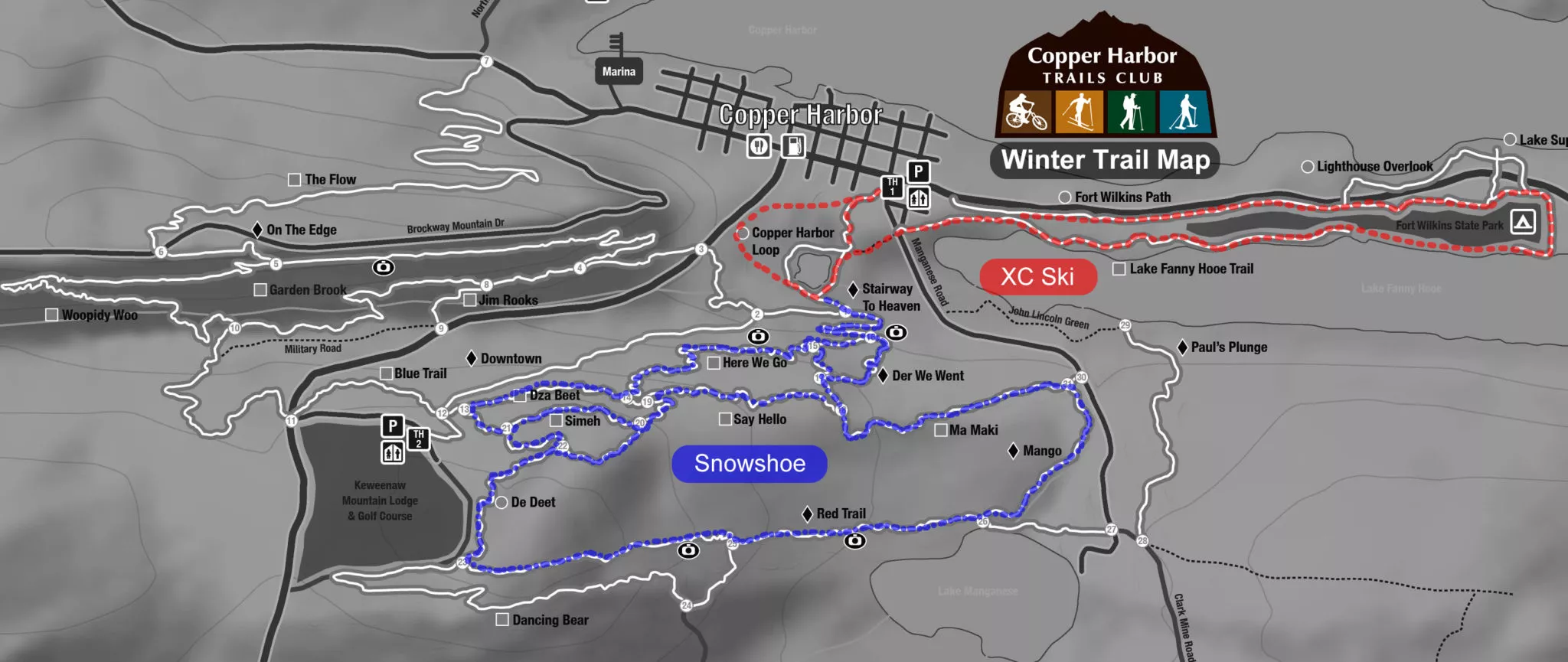 The Copper Harbor Trails Club grooms a 9km loop, tracked for classic XC skiing, between the village and throughout Fort Wilkins State Park. Some of the mountain bike trails are marked for snowshoeing during the snow covered months. Click the image to see a larger map and trail information!